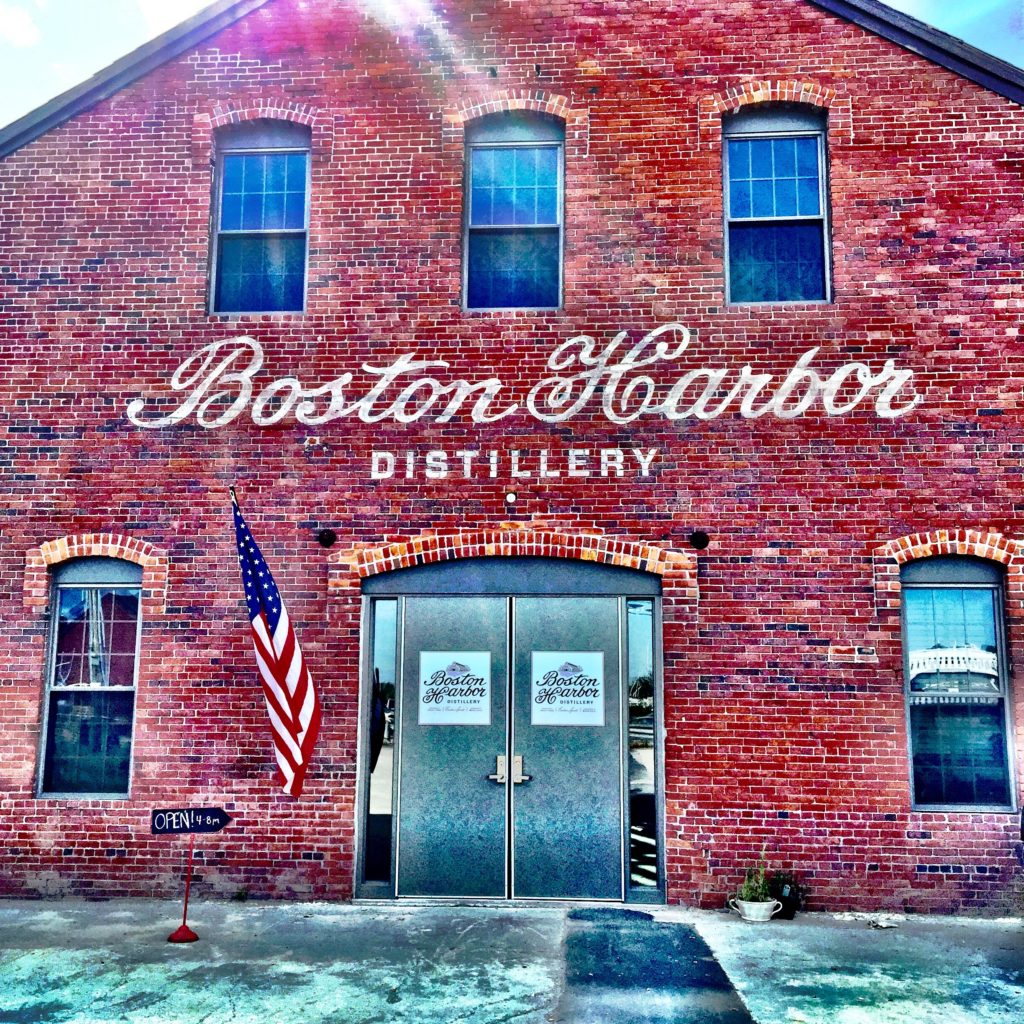
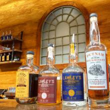
There is something truly spectacular about the essence of feeling like a local. Soaking up the history, yet exploring the ever-changing world around you. Boston’s newest piece of culture-in-the-making lies at 12R Ericsson St, the Boston Harbor Distillery. This brand new business is located in a building with culture as rich as its spirits. The beautiful brick facade once was home to other local institutions, like the Putnam Nail Factory, the George Lawley & Sons Shipyard, and Seymour’s Ice Cream. The Boston Harbor Distillery continues to honor the history of these past businesses with the names of their first three brands: the Putnam New England Rye Whiskey, the Lawley’s New England Spirit, and the Seymour’s Local Roast Coffee Liqueur.
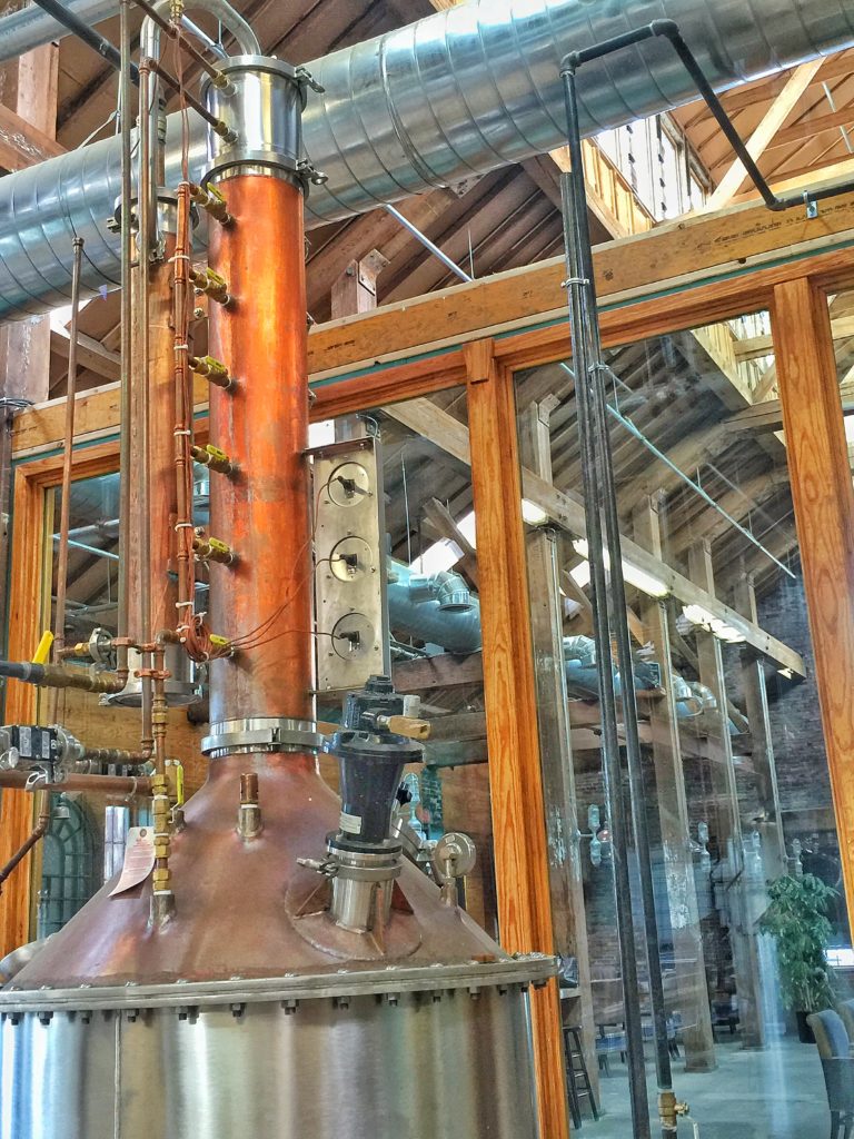
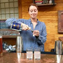
The brick exterior of the distillery provides a rustic feel, inviting visitors inside for a taste for more. After a tour of the space and a sampling of the spirits, it is impossible to not feel like a long time local of Boston, drinking in the culture surrounding you. Manning the stills were two young distillers who you meet by first name. In speaking with them, it is clear the passion they have for their craft. Upon entering the great room, you’re instantly made to feel at home and greeted with warm smiles by the barkeep – a young transplant from Texas who makes a mean Old Fashion and other craft cocktails with spirits produced just a few feet away. Behind her, stacks of crystal drinkware sparkle on shelves fashioned from belts and reclaimed wood. The modern, yet cozy interior is filled with honey-colored wood and plush plaid fabrics, whisking you away from the hustle and bustle of the city.
In fact, the distillery itself is nestled in a part of Boston that is off the beaten path, but within earshot of the gentle hum of the highway. “The Port”, as the owner of the distillery refers to it, has been a home to local craftsmen for hundreds of years, and with the addition of this latest venture, the neighborhood continues its legacy of homegrown goods. The Boston Harbor Distillery carries on the tradition of past commerce and culture, while redefining American spirits. You’ll come for the drinks, and stay for the experience that truly captures the history and local spirit of Boston.
The City of Boston has officially kicked off its neighborhood engagement campaign for Imagine Boston 2030 with the launch of the Textizen mobile platform. This is an opportunity for everyone who lives, works and plays in the City of Boston to help shape its future.
This platform will allow people to use mobile technology to engage from anywhere. To participate, simply text the letter of your top choice in response to the question below to (617) 860-3745:
My life in 2030 will be better with (pick your top choice)…
A: Housing I can afford
B: Safer neighborhoods
C: Better transportation options
D: Quality education for all
E: A more environmentally friendly city
F: Great parks and public space
G: A more innovative and creative city
H: Expanded job opportunities
I: More vibrant neighborhoods
There are also other ways to be a part of the conversation:
Take the Imagine Boston 2030 survey and sign up for email notifications on their website.
Follow the project on social media (Twitter, Facebook, Instagram) and post comments and suggestions using the hashtag #ImagineBoston.
Look for suggestion boxes around the city where you can submit your ideas on paper. Suggestion boxes will be at libraries, City Hall, on the City Hall To Go truck and more!
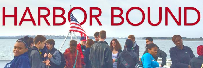
For over 20 years, The Boston Harbor Association has taken students out to Deer Island to visit and tour the wastewater treatment plant and bring engagement into the subject of Environmental Science for area students. This fall, members of the TBHA staff will once again lead hundreds of students on this interactive learning exercise.
Students will have the opportunity hop a ride on the ferry provided by Mass Bay Lines from Rowes Wharf for Deer Island, and then join a staff-led tour of the facilities while receiving instructions and background of the historic island. Topics covered during the tour will often depends upon the students level of understanding, but will range from engineering, science, and mathematics. Often the history of the city of Boston and its city planning will be covered during the tours.
Harbor Bound is made possible by generous support of the Massachusettes Water Resource Authority, MIT Alums, Mass Environmental Trust and other federal and private grants. The Boston Harbor Association offers Harbor Bound tours twice a year: during the Fall and the Spring semesters.
Next month, I become President and CEO of Riverlife, an organization which works to reclaim, restore, and promote Pittsburgh’s riverfronts. Riverlife’s vision calls for a grand, 13-mile continuous system of riverfront parks and trails, and large numbers of visitors and residents are already enjoying the existing riverfront open spaces and amenities.
As I prepare to leave The Boston Harbor Association after 24 years, I am reminded of the dedicated efforts of so many people to help transform Boston’s waterfront. During that time, we have been fortunate to have had the strong support of each Governor, Speaker of the House, and Senate President, as well as Boston Mayors Ray Flynn, Tom Menino, and Marty Walsh. Bipartisan political support, and the efforts of Judges Garrity, Mazzone, and Stearns and of public agency staffs, helped to make possible the clean up of Boston Harbor, restoration of Boston Harbor beaches, and enhancement of Boston Harbor Islands. The 41-mile HarborWalk public access network through Boston’s six waterfront neighborhoods, constructed by waterfront property owners in response to state tidelands requirements, is used and enjoyed by thousands of people every day.
The transformation of Boston’s waterfront is extraordinary, and is a model for other waterfront communities. Thank you to all of you for your support of our efforts in the revitalization of Boston Harbor.
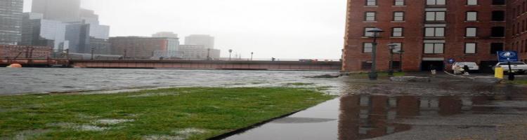
Events such as Superstorm Sandy highlight the growing relevance of climate change and draw attention to the importance of taking steps today to be prepared for the likely events of tomorrow. Preparing for the Rising Tide provides policy makers, planners and property owners with site-specific examples of how to assess vulnerability and increase resilience to coastal flooding over time.
Preparedness plans need to be robust enough to handle any future condition, and/or flexible enough to change over time to meet needs as they arise. Ideally they include “no-regret” and co-benefit” solutions that extend beyond flood control goals. Cost-effective preparedness plans will result in both “here and now” and “prepare and monitor” actions based on threshold triggers such as sea level rise.
Previous reports have described a range of large-scale adaptation strategies. This report takes those recommendations and applies them to specific properties in Boston. Some cities such as Seattle, WA and Charleston, SC are developing “floodable zones” that preserve the city’s access to its waterfront while minimizing damage when periodic flooding occurs. This concept of “living with water” is an option to consider in Boston as well.
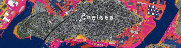
Drs. Paul Kirshen and Ellen Douglas and Mr. Chris Watson developed these maps in 2010 to show the impact of 2.5 feet, 5 feet and 7.5 feet of flooding above mean high tide on the Boston Harbor coastline. As they explained in their presentation, this flooding can occur through one or more of three main reasons: 1) sea level rise, 2) astronomical high tides (when the moon and the sun align) and 3) storm surges.
Climate change is already increasing the likelihood of coastal and riparian (river) flooding due to sea level rise and extreme weather events. Astronomical high tides occur four to six times every year. As the impacts of climate change are increasingly felt, we can expect coastal flooding events to become more frequent and more severe, even during this century.
Methodology
To Download Maps
These maps are free for public use; please credit The Boston Harbor Association. To download high-resolution versions, click once on the image of the map to pull up a larger version. Right click on the larger map and select “Save As.” If you right click on the smaller version of the map, you will only download a low-resolution image.